Free for iPhone

Every photo,
right where you shot it.

GPSPROTrack records your whole shooting day on one battery charge and hands you a single GPX file. Drop it into Lightroom and every frame lands on the map — from any camera, even one without built-in GPS.

No account. No ads. No tracking. Your track never leaves your phone unless you share it.

GPSPROTrack recording a track on the map
All dayon one charge
Any camerano GPS module needed
0data collected
Freeno subscription

Built for a long day behind the camera.

Start it in the morning, forget it in your pocket, export in the evening.

📷

Works with every camera

Nikon, Canon, Sony, Fujifilm, Leica, drones, film scanners — any camera, even without a built-in GPS module or sensor. Shoot with several bodies at once and one GPX geotags them all.

🔋

Battery first

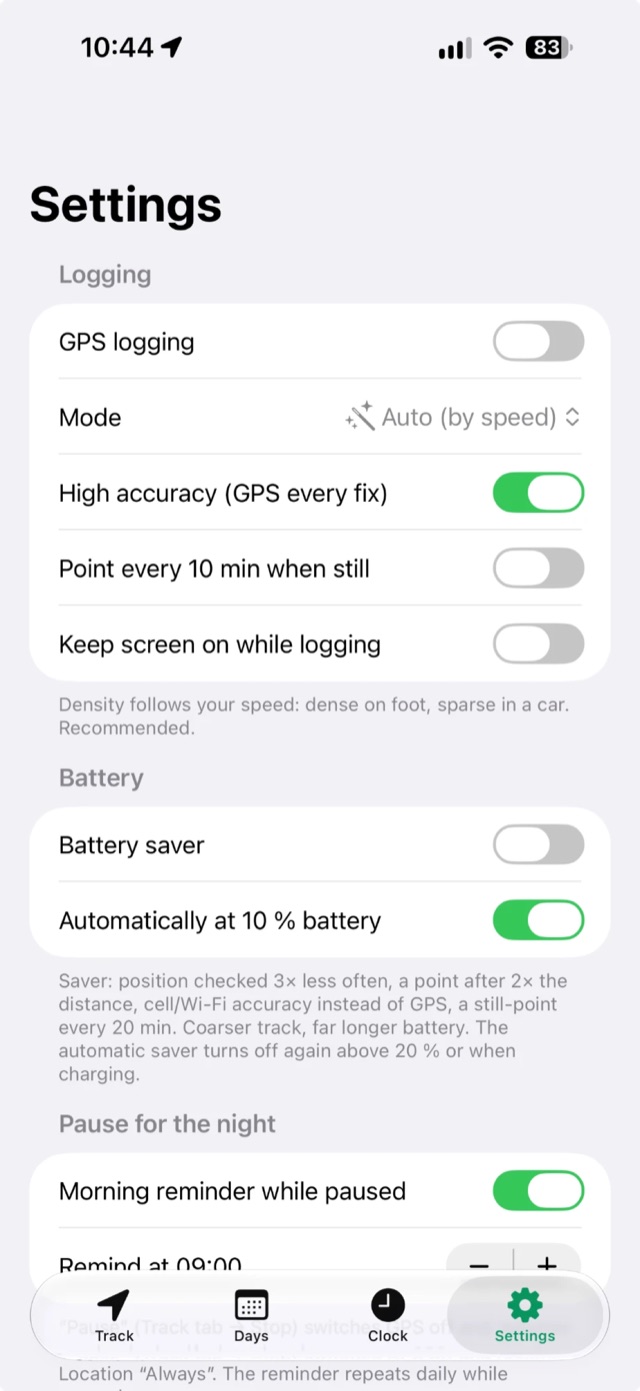
Smart duty cycle keeps the GPS radio asleep between samples. Roughly 1–3 % extra per hour, about 10–25 % for a 12-hour day. Auto saver at 10%.

📁

Projects

Group days into a shoot or trip and export the whole project as one GPX file.

🌙

Pause for the night

Pause at the hotel. Logging resumes by itself when you start moving the next morning.

🕒

Camera clock fix

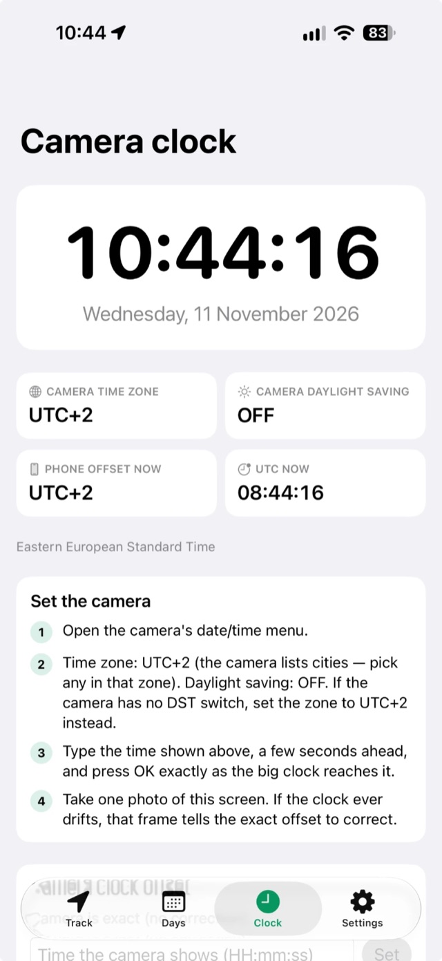
Set the camera’s time zone and offset once. The GPX is shifted so photos match perfectly.

🗺️

Map & navigation

Full-screen map with day filters. Tap any point to open it in Apple Maps, Google Maps, Waze, Bolt or Uber.

⛰️

Altitude & stats

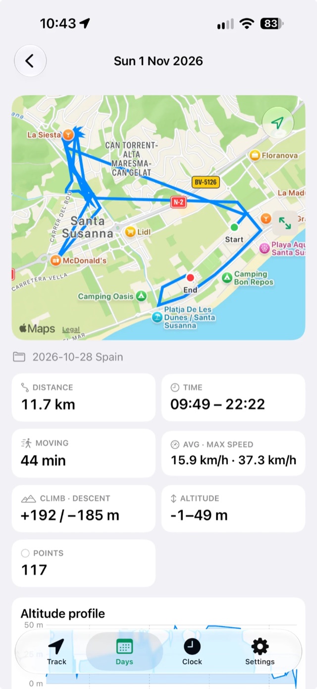
Distance, points and an elevation profile for every day. Live Activity on the Lock Screen.

☁️

files.fm backup

Optional automatic upload of every day’s GPX to your own files.fm account, every 2 minutes while logging. Your track is safe even if the phone is lost.

☁️ Back up tracks to files.fm automatically

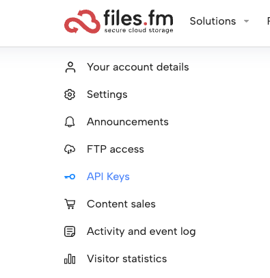
Turn it on in Settings → files.fm. While you log, the day’s GPX is uploaded every 2 minutes into a folder you choose, and the older copy is replaced, so the folder always holds one current file per day. Open it on your computer and the GPX is already there — no AirDrop needed.

How to connect: log in at files.fm, open the account menu → API Keys, create a key and paste your login and the key into the app.

The login and key are kept in the iPhone Keychain on this device only, the key is never shown, and the app talks only to files.fm. Off by default.

files.fm account menu with API Keys highlighted

Simple on purpose.

Four tabs. Everything a photographer needs, nothing else.

Track tab
TrackStart, pause, log a point
Day detail
DaysMap, stats, elevation
Clock tab
ClockMatch your camera time
Settings
SettingsBattery, pause, safety

A free alternative for geotagging photos.

Looking for a Geotag Photos alternative or a simple way to geotag photos from your iPhone? GPSPROTrack does the job without an account, a subscription or a cloud service.

💸

Free, no subscription

All features are included. No in-app purchases, no trial that runs out in the middle of a trip.

🔒

No account, no cloud

Tracks stay on your iPhone. Export a standard GPX file and share it however you like.

🧩

Works with your tools

Lightroom Classic, Capture One, Photo Mechanic, GeoSetter, ExifTool and anything that reads GPX.

📷📷📷 “My camera app already sends GPS from the phone”

True — Nikon SnapBridge, Canon Camera Connect, Sony Creators’ App, Fujifilm XApp and others can pass the phone’s location to the camera. But they usually pair with one camera at a time, often only from one brand, and the link drops when the phone sleeps or the camera is switched off. Shoot with two or three bodies — a wide and a tele, a second shooter, a backup body, a drone or an action cam — and only one of them gets coordinates.

GPSPROTrack does not connect to any camera at all. It records one track on the phone, and that single GPX geotags every camera you carry — any brand, any number, old bodies without Bluetooth too. The only thing they need is the same, correct time.

Geotag Photos, SnapBridge, Camera Connect, Creators’ App and XApp are trademarks of their respective owners. GPSPROTrack is an independent app and is not affiliated with them.

Years of shoots, every photo on the map.

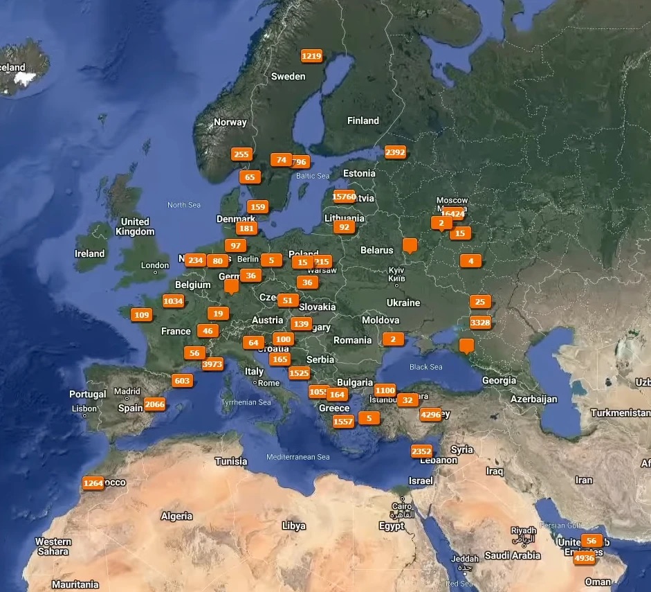
This is what a geotagged archive looks like: tens of thousands of photos from trips and jobs across Europe and beyond, each one placed where it was taken. The numbers show how many photos were shot in each place.

Map of Europe and the Middle East with clusters of geotagged photos and photo counts per location
A real photo archive, geotagged with GPS tracks. Find any shoot by place, not just by date.
Pro · on your Mac

Geotag a whole folder on your Mac. No Lightroom needed.

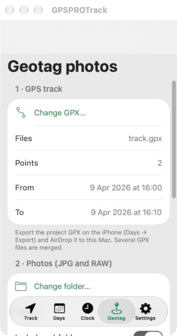
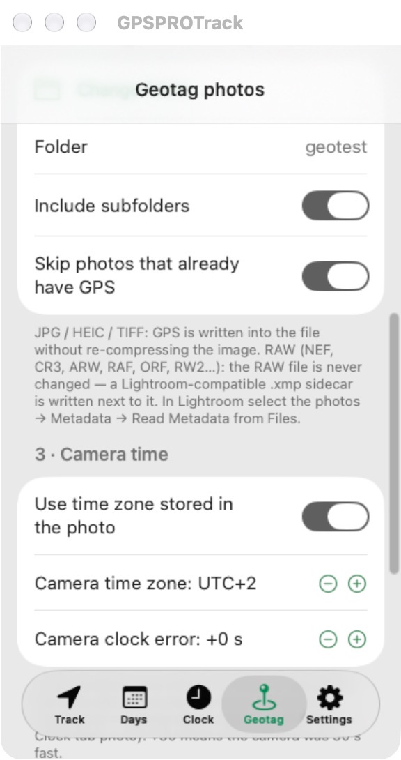
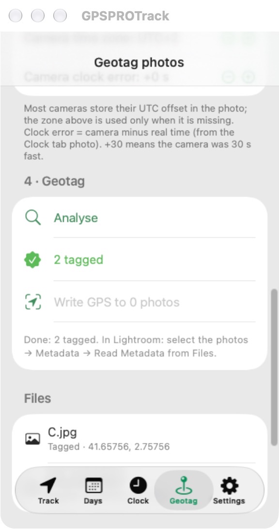
Open GPSPROTrack on an Apple Silicon Mac and a Geotag tab appears. Pick the GPX, pick the folder with your JPG and RAW files, and the app writes the GPS position into each photo’s metadata.

Mac Geotag tab: GPX file loaded
1 · GPXOne or several files
Mac Geotag tab: photo folder and camera time
2 · PhotosJPG + RAW folder
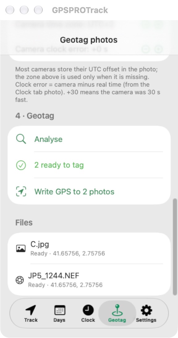
Mac Geotag tab: analyse result, photos ready to tag
3 · AnalysePreview, nothing written
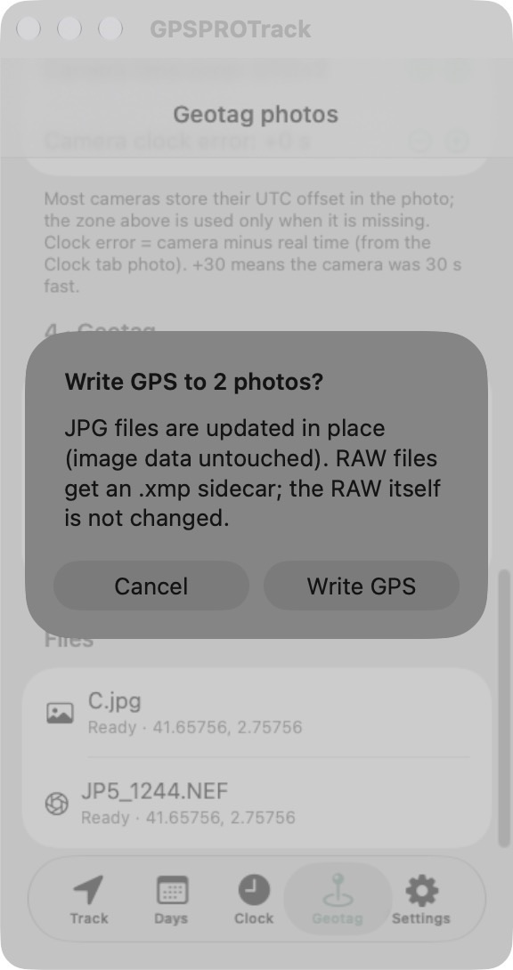
Mac Geotag tab: confirmation before writing
4 · ConfirmYou decide
Mac Geotag tab: photos tagged
5 · DoneGPS in every photo
🛡️

Your RAW files are never touched

NEF, CR3, ARW, RAF, ORF, RW2 and other RAW files stay exactly as they are. GPS goes into a Lightroom-compatible .xmp sidecar next to each RAW.

🖼️

JPGs without re-compression

JPG, HEIC and TIFF get GPS written into the file. Only the metadata changes. The image itself is not re-encoded, so the pixels stay identical.

👀

Preview first, write after

Analyse shows which photos will be tagged, which are outside the track and which already have GPS. Nothing is written until you confirm.

🕒

Time zones handled

Uses the time zone stored in the photo when the camera saves one, otherwise the zone you set. The camera clock error from the Clock tab is applied too.

📍

Accurate positions

Positions are interpolated between track points. Photos already carrying GPS are skipped by default.

🔒

Offline and private

Everything happens on your Mac. No upload, no account, no internet needed.

Requires a Mac with Apple silicon (M1 or later). The Mac Geotag tab arrives in the next app update. After tagging RAW files, in Lightroom select the photos → Metadata → Read Metadata from Files.

Everything GPSPROTrack can do

The complete list, all free.

📍 Logging

• One big Start / Stop button
• Auto mode adapts to walking, cycling or driving
• Walking, Cycling, Driving or Custom intervals
• Keeps logging with the screen off (Location “Always”)
• Resumes by itself after a restart
• “Log point now” and “Mark this spot” waypoints
• Works offline, no connection needed

🔋 Battery

• GPS sleeps between short position fixes
• Battery saver, manual or automatic at 10 %
• Pause for the night with automatic resume when you move
• Morning reminder when paused
• “Still logging?” reminder after a long stop

📁 Projects & days

• Name a project for each shoot or trip
• One track per day, grouped by project
• Distance, moving time, speed, altitude and climb
• Elevation profile for each day
• Delete a day or a whole project (with confirmation)

🗺️ Map

• Live map of today’s track
• Full-screen map: all days, one project or one day
• Tap any spot to open it in Apple Maps, Google Maps or Waze
• Or use it as the drop-off in Bolt or Uber
• Sunrise and sunset times

📤 Export

• Standard GPX: one day or the whole project in one file
• Share via AirDrop, Files, Mail or any app
• Optional automatic upload to your own files.fm account
• Works with Lightroom Classic, Capture One, Photo Mechanic, GeoSetter, ExifTool

🕒 Camera clock

• Big clock to set the camera to the second
• Time zone and daylight-saving advice
• Measure the camera clock error and apply it to the GPX

📱 Lock Screen

• Live Activity with distance, time and points
• Stop button on the Lock Screen and Dynamic Island

💻 Pro on Mac

• Geotag tab on Apple Silicon Macs
• GPS into JPG / HEIC / TIFF without re-compression
• .xmp sidecars for RAW, RAW files never changed
• Preview before writing, skip already-tagged photos

No account, no ads, no tracking, no data collected.

From shoot to geotagged in three steps.

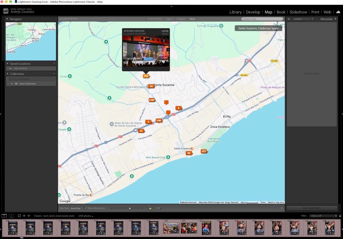
Lightroom Classic Map module showing 2,709 photos geotagged from a GPSPROTrack GPX file
The result in Lightroom Classic: 2,709 photos from several cameras, placed on the map from one GPSPROTrack GPX.

⏱ First and most important: match the camera clock to the second

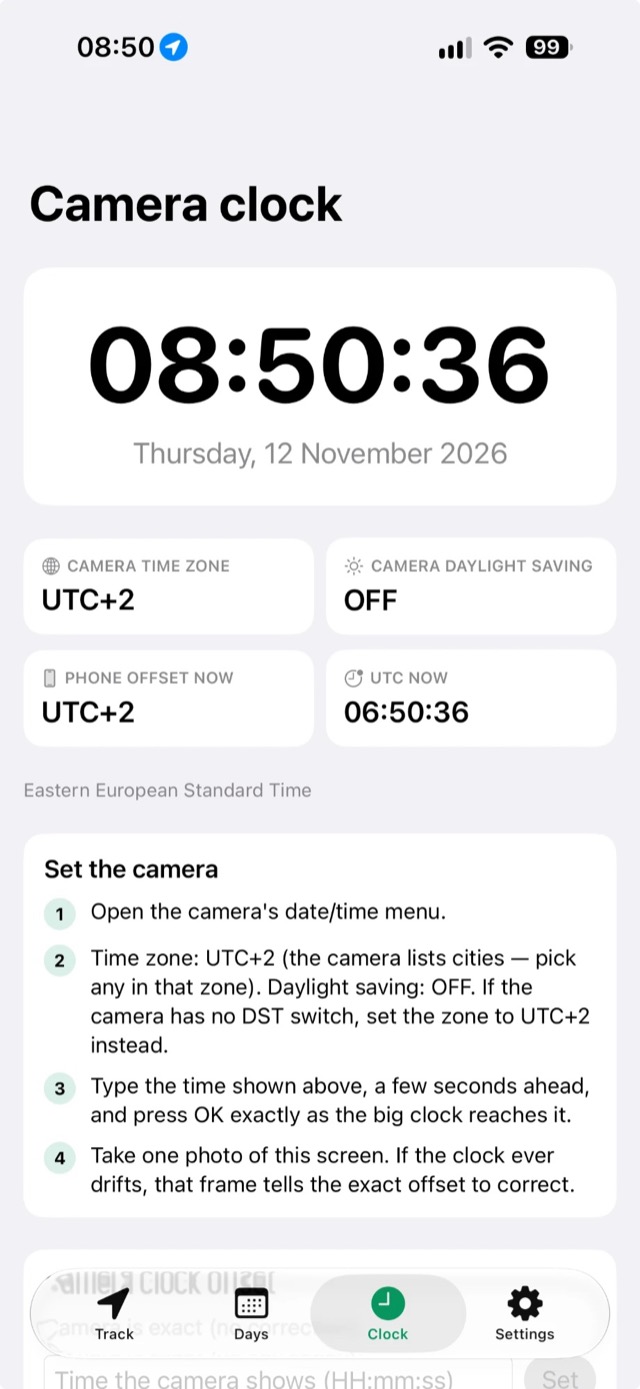
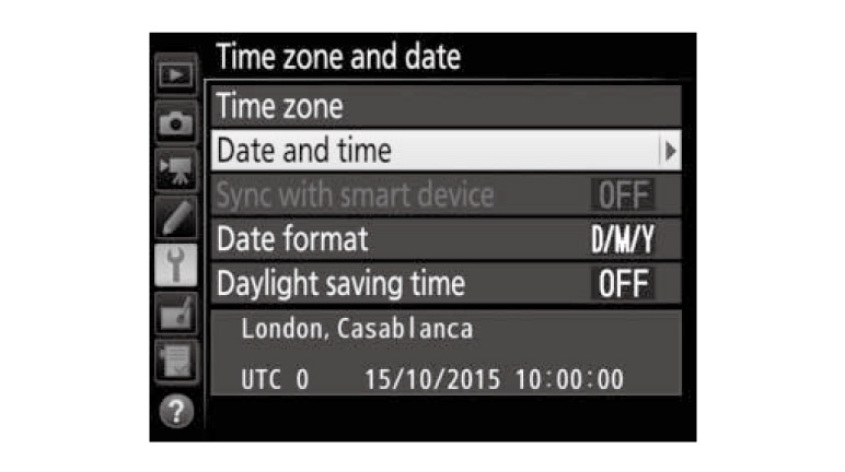
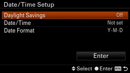
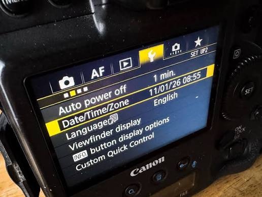
Lightroom places photos by time. Before you shoot, set every camera to exactly the time shown in the app’s Clock tab, down to the second, with the same time zone and daylight saving. Type a time a few seconds ahead and press OK as the big clock reaches it.

GPSPROTrack Clock tab
GPSPROTrackClock tab
Nikon time zone and date menu
NikonTime zone and date
Sony Date/Time Setup menu
SonyDate/Time Setup
Canon Date/Time/Zone menu
CanonDate/Time/Zone

Start logging

Name your project and press Start. Allow location “Always” so the track continues with the screen off.

Shoot all day

Keep the phone in your pocket. Pause overnight; it resumes when you move.

Export & geotag

Tap Export, share the GPX to your Mac. In Lightroom: Map → Tracklog → Load Tracklog → Auto-Tag.

Quick help

Does the app have to be running when you’re taking the photos?

Logging has to be on, but the app does not have to be open. Press Start logging before the shoot, lock the phone and put it in your pocket. GPSPROTrack keeps recording in the background with the screen off (iOS shows a small blue location indicator). You shoot with your camera as usual — the app never talks to the camera. Afterwards the GPX track is matched to your photos by time.

Just don’t swipe the app away in the app switcher. If you do, iOS stops it. With the Always location permission, iOS can restart a paused session by itself. Photos taken before you pressed Start or after you pressed Stop cannot be geotagged, so start a little early.

Logging stops when the app is closed?

Open iOS Settings → GPSPROTrack → Location and choose “Always”. Keep Background App Refresh on.

Photos land in the wrong place?

Open the Clock tab and set the camera’s time zone and daylight saving exactly as shown on the camera. The exported GPX is shifted to match.

How do I geotag in Lightroom Classic?

Library → select photos → Map module → Tracklog button → Load Tracklog → choose the GPX → Auto-Tag Selected Photos.

Lightroom Classic module bar with Map selected

Then click the wavy-line Tracklog icon in the toolbar under the map and choose Load Tracklog…:
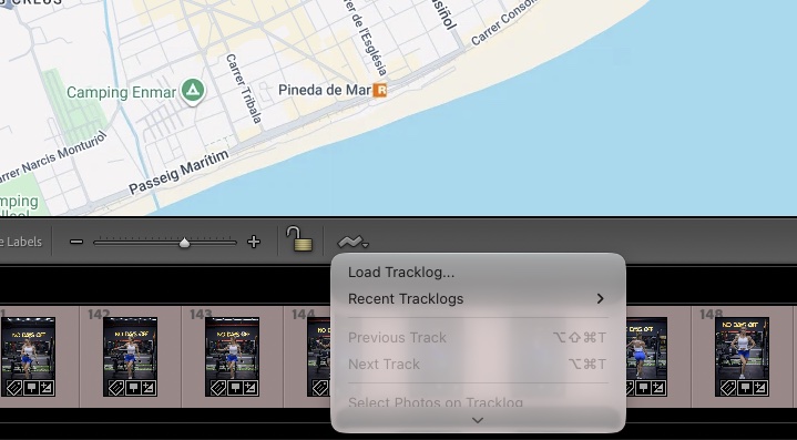
Lightroom Map module toolbar with the Tracklog menu open on Load Tracklog

After loading, pick the right date in the Track: menu, or All Tracks if your photos span several days. Then select the photos and choose Auto-Tag Selected Photos from the Tracklog menu.
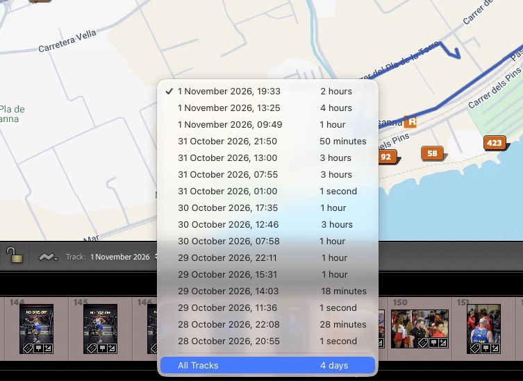
Lightroom Track menu listing tracks by date with All Tracks at the bottom

Select all photos in the filmstrip (⌘A), open the Tracklog menu and press Auto-Tag … Selected Photos:
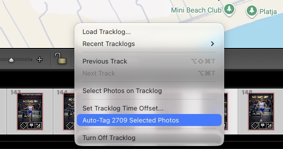
Lightroom Tracklog menu with Auto-Tag 2709 Selected Photos highlighted

With All Tracks selected you see every track on the map, and the photos land exactly where they were taken:
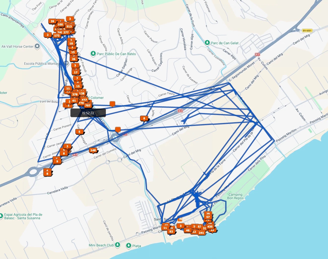
Lightroom map showing all GPSPROTrack tracks with geotagged photos

Every photo now has GPS coordinates. Export them as JPGs and the location stays in the file. When you share them with clients, the photos appear on the map in their phone’s gallery:
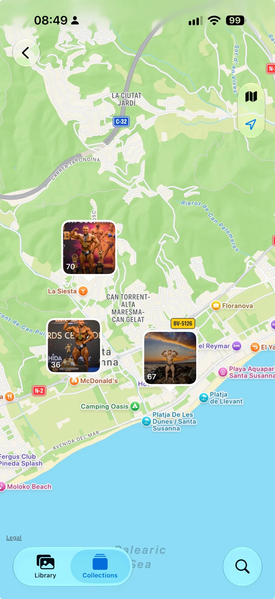
Shared photos shown on the map in iPhone Photos
My camera’s phone app already adds GPS. Why do I need this?

Camera apps (SnapBridge, Camera Connect, Creators’ App, XApp…) usually send location to one paired camera at a time. With two or more bodies, only one gets GPS. GPSPROTrack needs no connection: one track from the phone geotags all your cameras — any brand, any number — as long as their clocks are set right (Clock tab).

Is this an alternative to Geotag Photos?

Yes. Like other geotagging apps, GPSPROTrack records a GPS track while you shoot and lets you geotag photos afterwards from a GPX file. It is free, needs no account and keeps your data on the phone.

Does the app upload my location anywhere?

No. Tracks are stored only on your iPhone. Nothing is sent to us. See the Privacy Policy.

How much battery does it use?

Much less than a navigation app. The GPS sleeps between points and wakes only for short fixes. Rough estimates: about 1–3 % per hour, about 10–25 % for a 12-hour shooting day, and close to 0 % while paused overnight. Slow walking with good signal is at the low end. Fast driving or weak signal in mountains is at the high end. At 10 % battery the saver turns on automatically and stretches the intervals further. Exact numbers depend on your iPhone, battery health and signal.
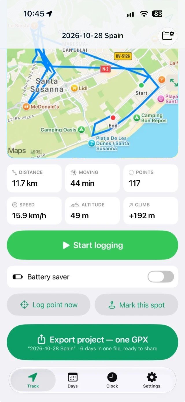
Need help?

Questions, bug reports or feature ideas are welcome.

prophotoculler@gmail.com