Why I built GPSPROTrack — a free Geotag Photos 2 alternative
One iPhone app that quietly records where you were all day, barely touches the battery, and in the evening geotags every photo with a single GPX file — from all your cameras at once.
By photographer Andrejs Zavadskis · zavadskis.eu
Who is it for?
Especially for anyone who shoots abroad, moves around a lot, or simply photographs a family trip with the “big” camera. The phone in your pocket already knows where you are. GPSPROTrack keeps all of it in one GPX file, and after the trip you AirDrop it to your Mac.
In Lightroom Classic, go to Map → Tracklog → Load Tracklog, pick the file, and every photo gets its coordinates automatically — exactly where you took it.

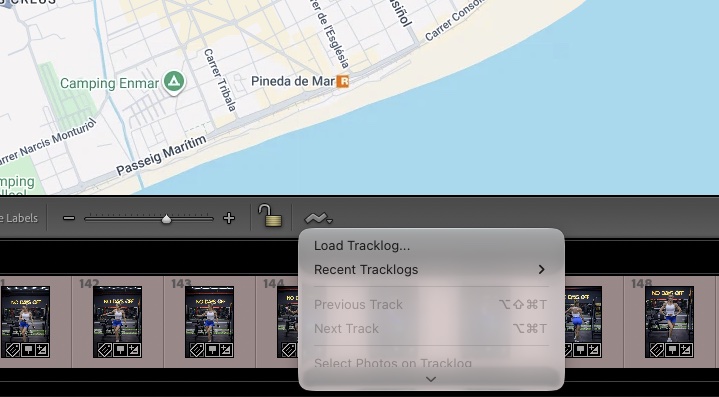
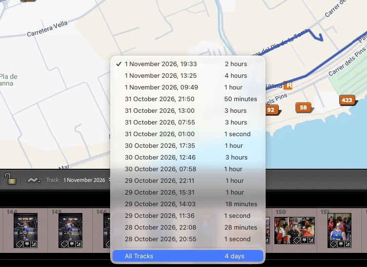
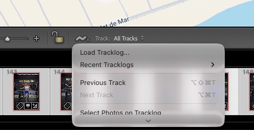
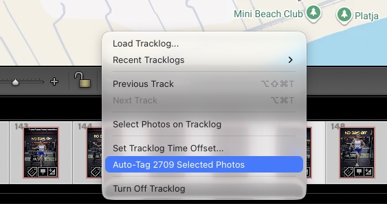
4. Select all photos in the filmstrip (⌘A), open the Tracklog menu and press Auto-Tag … Selected Photos.
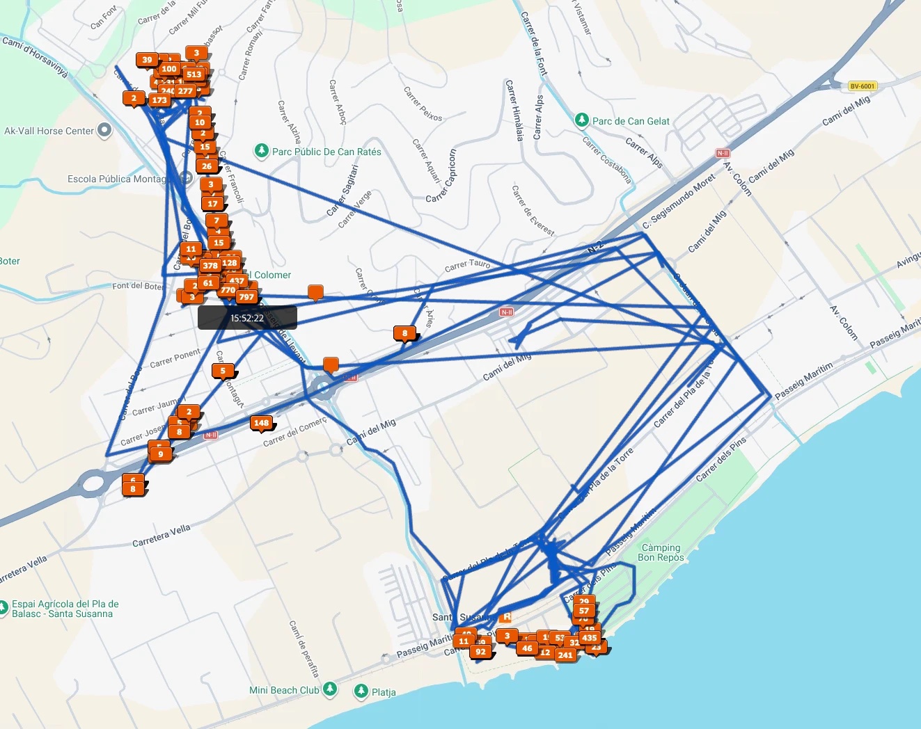
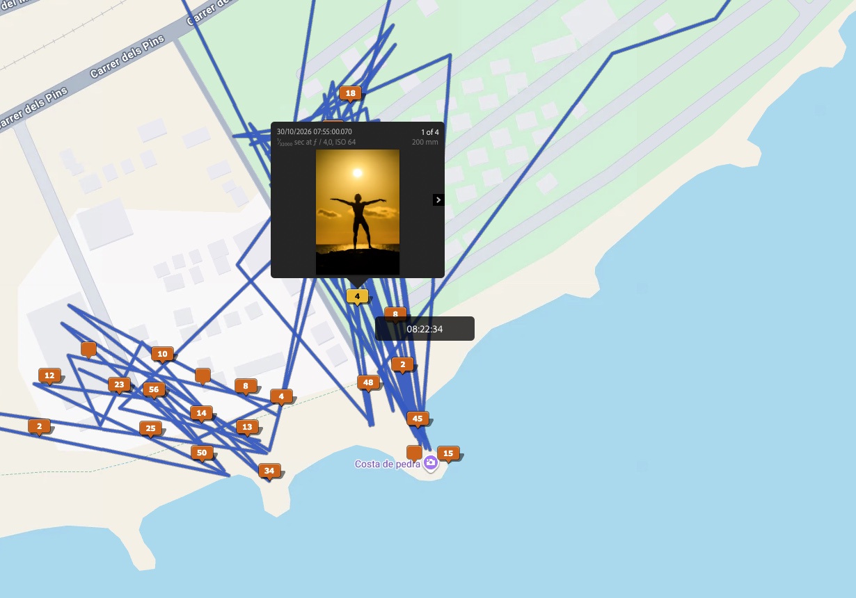
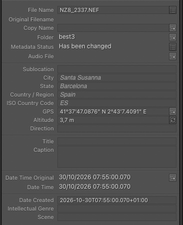
6. Every photo gets precise GPS coordinates and altitude. Lightroom also fills in the city, region and country.
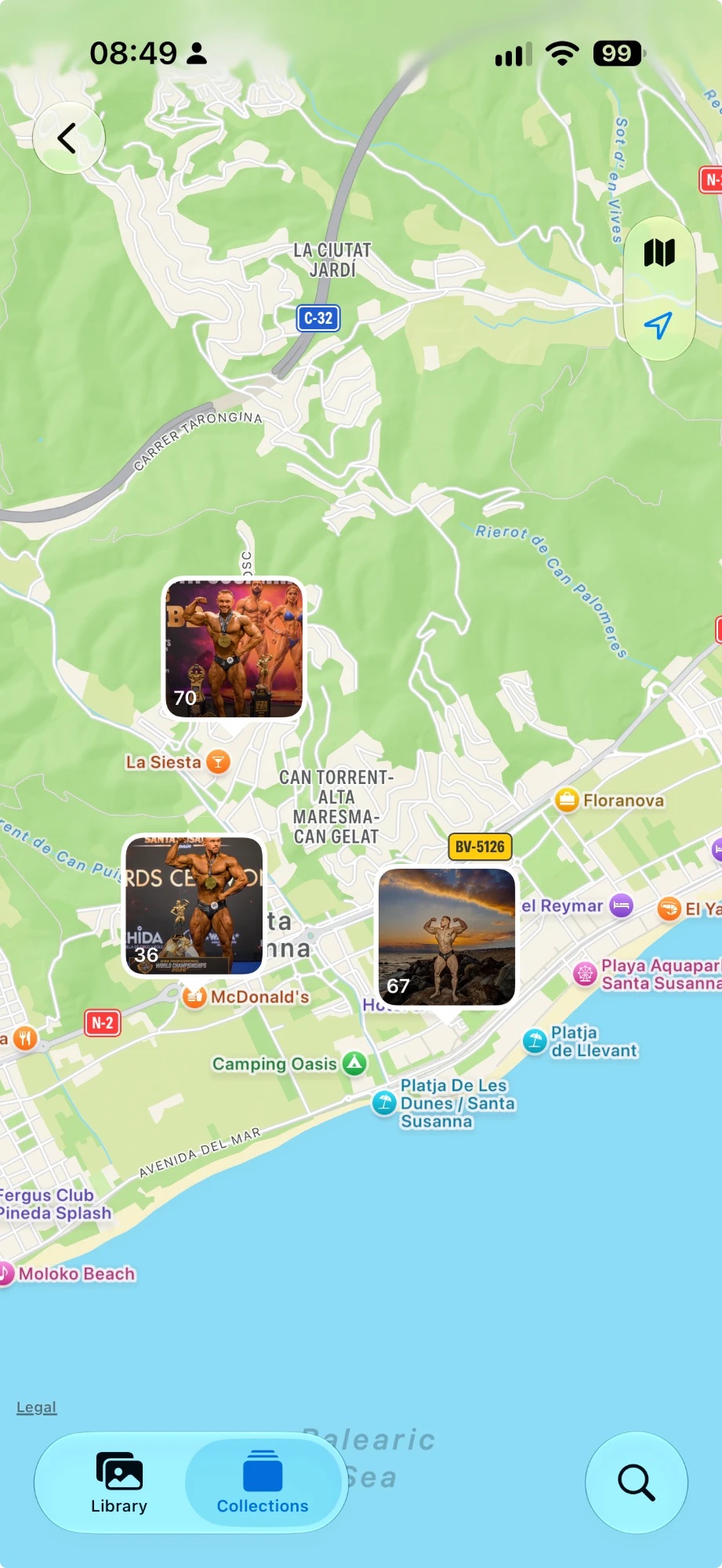
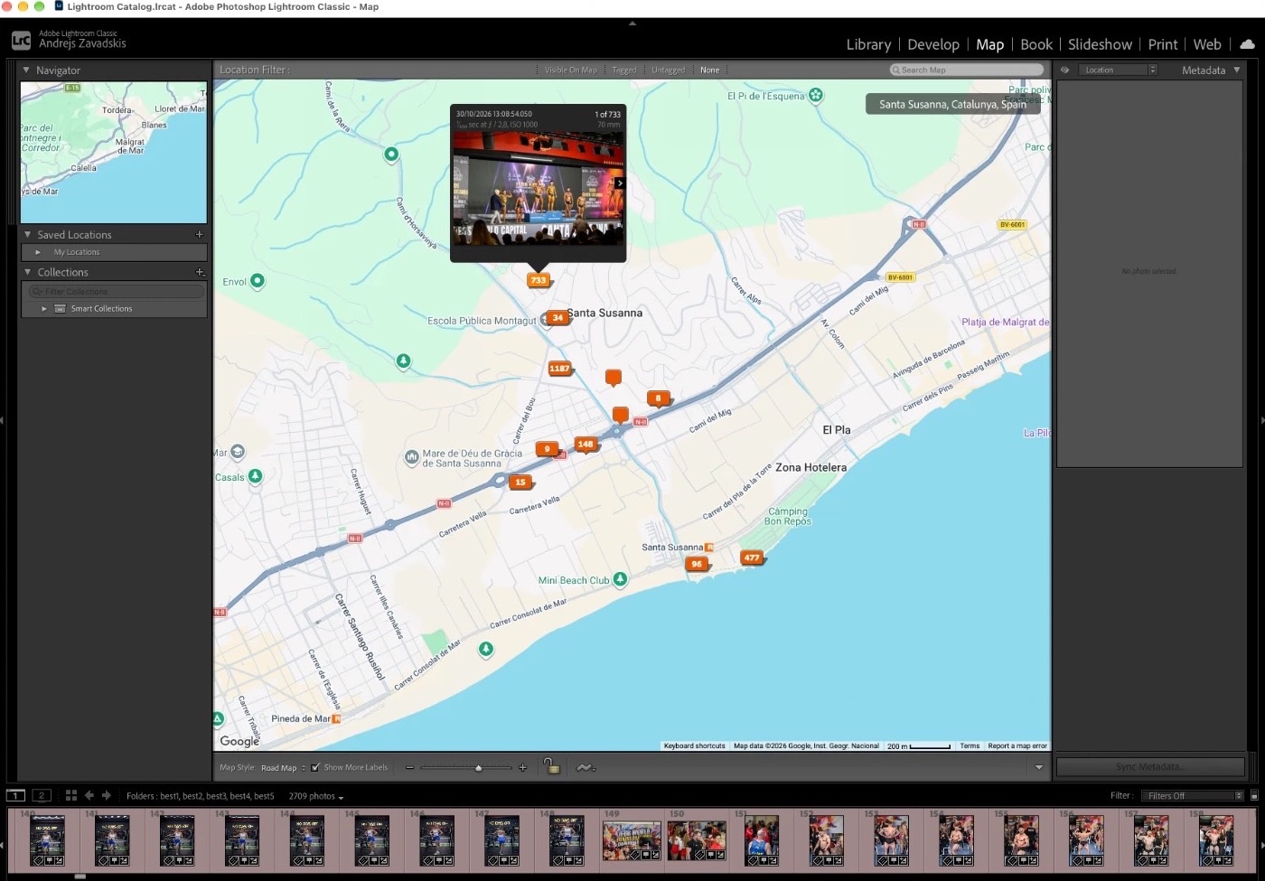
Clients were genuinely amazed when I AirDropped them the photos and they instantly showed up on the map in iPhone Photos — right next to the pictures from their own phones. Many called it a “wow” feature.
20 years of geotagging
I’ve been adding coordinates to my photos for about 20 years. In the beginning that took separate devices — GPS loggers you had to charge, carry and remember to switch on. Now the phone does the same job and, what I really like, uses so little battery that you can forget about it. I use it on every trip: family holidays and all my projects abroad.
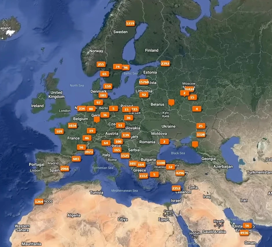
“My camera already has GPS”
Yes, many do. But many don’t, and I usually shoot with three cameras at once. Built-in GPS only works for that one camera. With GPSPROTrack you need just one thing: the same, accurate time on every camera. After that it doesn’t matter how many cameras you have — one GPX file geotags them all.
On forums people often answer: “My camera’s app already sends GPS from the phone.” That works — for one camera. SnapBridge, Camera Connect, Creators’ App and similar apps usually stay paired with one body at a time, and the link drops when the phone sleeps or the camera is off. A second body, a second shooter’s camera, a drone or an old camera without Bluetooth gets nothing. GPSPROTrack does not connect to cameras at all, so it works with as many cameras as you carry, of any brand.
⏱ The only rule: accurate time
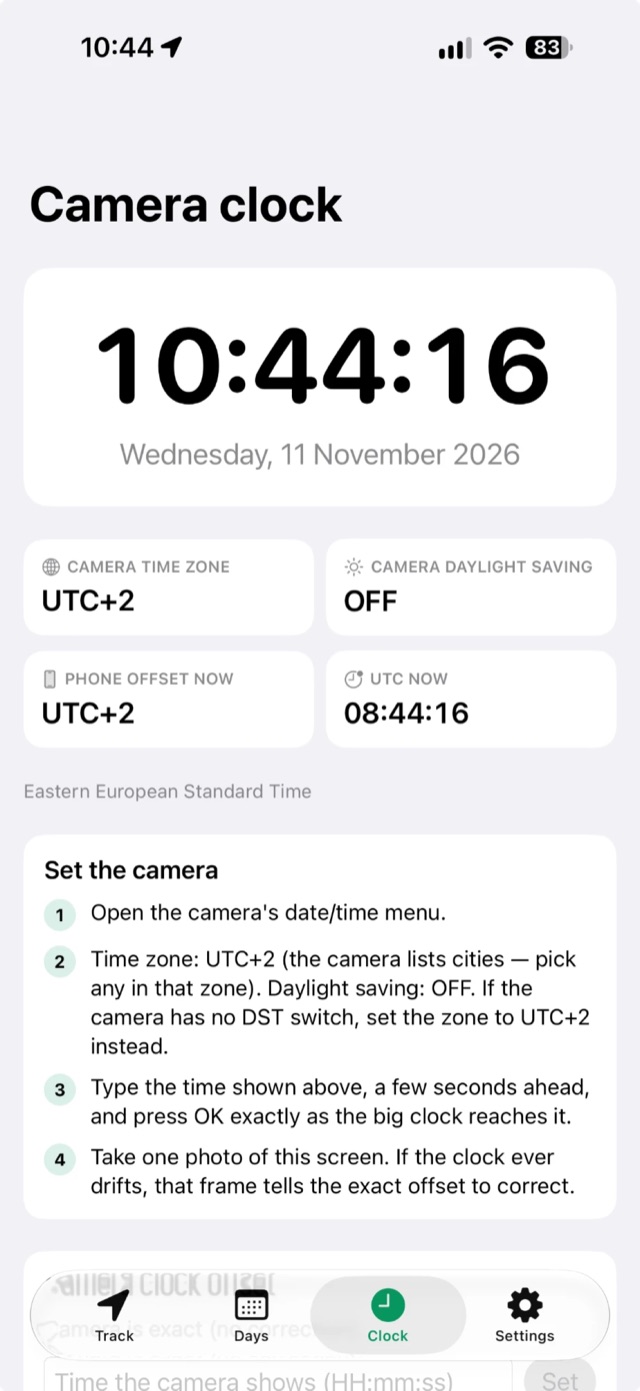
The camera clock must match the phone. The app has a Clock tab showing the exact time and the time zone as “UTC+2”, just like your camera, so you can sync it by hand. If you forgot to set the camera, enter the offset and the GPX is shifted so photos still land in the right place.
Most important: camera time to the second
Before you shoot, set every camera to exactly the time shown in the app’s Clock tab — down to the second. Lightroom assigns coordinates by time: if the camera runs a minute fast, a photo lands where you were a minute later.
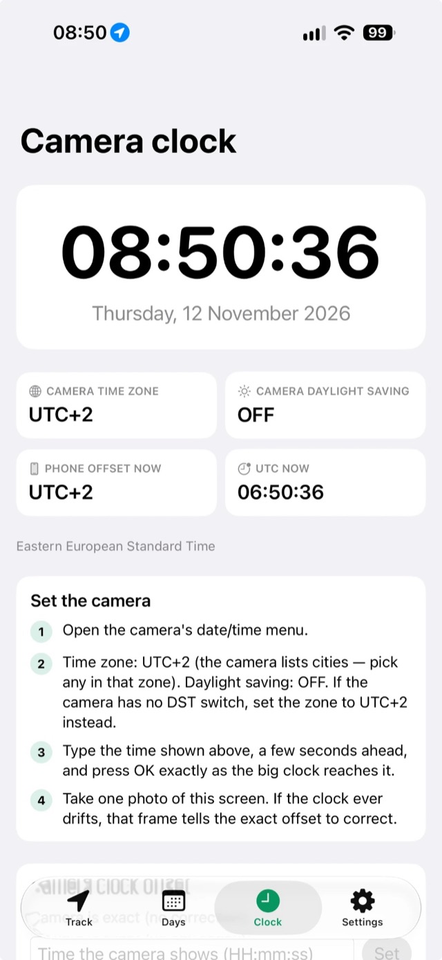
- Open the camera’s date/time menu.
- Set the time zone and daylight saving (DST) as the app shows.
- Enter a time a few seconds ahead and press OK exactly as the big clock reaches it.
- Take a photo of the Clock screen. If the camera clock ever drifts, that frame shows the exact offset to correct in the app.
- Repeat for every camera.
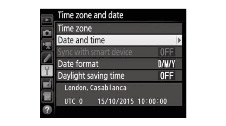
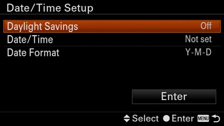
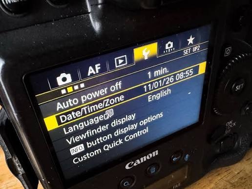
Where to find it on different cameras:
Key features
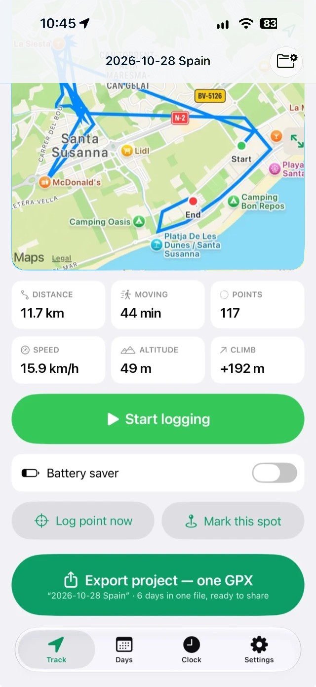
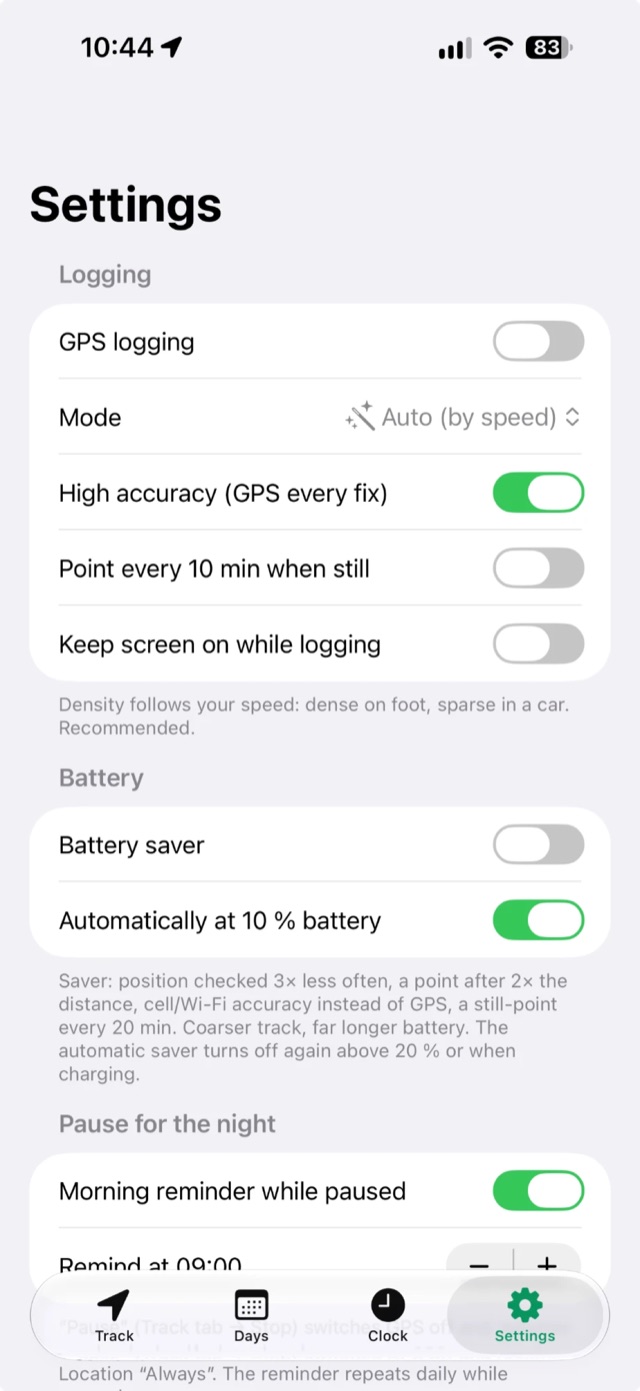
- Battery first. GPS is not on all the time. Between points the app uses cell towers, takes a short precise fix and goes back to sleep. At 10 % battery the saver turns on automatically.
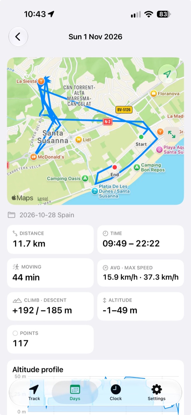
- Projects. Group days by trip or job and export the whole project as one GPX file.
- Pause for the night. Hit pause at the hotel — in the morning, when you start moving, logging resumes by itself. No more “forgot to switch it on”.
- files.fm / failiem.lv integration. Upload the GPX straight to your account and download it anywhere. Credentials are stored in the secure iPhone Keychain.
- Map and navigation. Full-screen map with day filters, elevation profile and a Live Activity on the Lock Screen.
- No account, no ads, no tracking. Your tracks stay on your phone.
Is it safe to run on my phone?
Yes. GPSPROTrack was built around three promises: protect your privacy, protect your battery, and never lose your track.
- Your location stays on your phone. There is no account and no ads, and the app never sends your track anywhere. The only thing it reports is an anonymous launch count (app version, device model) — and you can switch even that off in Settings.
- Only one optional connection. The app talks to the internet only if you choose to upload a GPX to your own files.fm / failiem.lv account. Those login details are stored in the encrypted iPhone Keychain, never in plain text.
- You are always in control. iOS shows the blue location indicator while logging. Press Stop and all location use ends immediately. Nothing is deleted unless you delete it yourself.
- Gentle on the battery. The app never keeps high-accuracy GPS running continuously. It saves itself at 10 % battery and switches to an even lighter mode automatically.
How much battery does it use?
Much less than a navigation app, because the GPS sleeps most of the time and only wakes for short fixes. Real numbers depend on your iPhone, its battery health, signal strength and how much you move, so treat these as rough estimates:
Walking slowly in a city with good signal sits at the low end. Driving fast, or poor signal in mountains, pushes it towards the high end. With the battery saver on, usage drops further.
Bonus: getting back to where you were
Because the app records all your movements, it doubles as a memory. On some jobs you run around a strange city like a zombie and by evening have no idea where you’ve been — and suddenly you need to go back. Open the map, tap a point, and it opens in Google Maps, Waze, Apple Maps, Bolt or Uber. You rarely need it, but when you do, it’s gold.
Getting started: three steps
- In the morning, open the app, name your project and press Start. Allow location “Always” so logging continues with the screen off.
- Shoot all day. The phone can stay in your pocket.
- In the evening, press Export, send the GPX to your Mac and use Auto-Tag in Lightroom.
Pro: geotag straight on your Mac
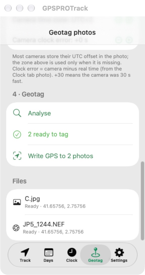
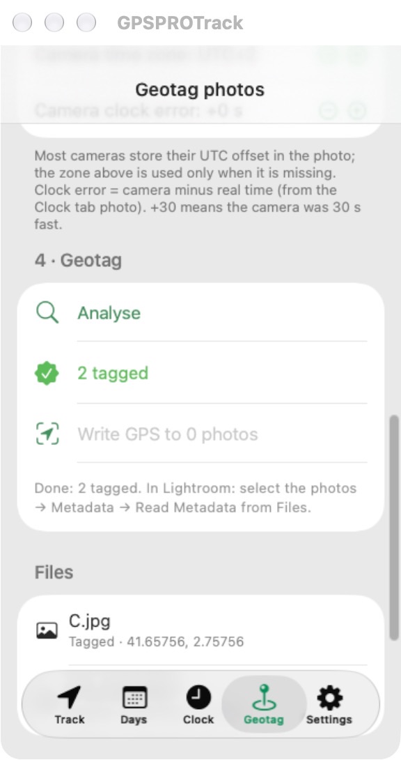
Not everyone uses Lightroom. Open GPSPROTrack on an Apple Silicon Mac and an extra Geotag tab appears. Choose the GPX, choose the folder with your JPG and RAW files, press Analyse to see what will happen, then Write GPS. JPGs get the position in the file without re-compression. RAW files are never touched: the app writes an .xmp sidecar that Lightroom and other tools read. The Mac tab arrives in the next app update.
Free — and there’s more to come
Lately I’ve been coding all kinds of tools that make life easier for photographers and videographers. I have about twenty of them by now. I got an Apple Developer account and will release some of them publicly and for free. GPSPROTrack is the first. Stay tuned — more are coming.
— Andrejs Zavadskis, photographer. See my work at zavadskis.eu.
Try GPSPROTrack
Free iPhone app. No account, no subscription.
Download on the App StoreQuestions and ideas: prophotoculler@gmail.com
Geotag Photos is a trademark of its respective owner. GPSPROTrack is an independent app and is not affiliated with it.